
Sources Around Hot Springs Neighbors
A useful block lookup begins with public geography. The Garland County parcel map preserves physical adjacency, even when owner names sort in an unrelated order. Each adjoining polygon can lead to an assessor card. Recorded plats explain lots, streets, and common areas. Voter data and city files then answer narrower questions under their own access rules.
| Block Source | What It Can Show Nearby | Access Route |
|---|---|---|
| GIS parcel map | Adjoining parcels and parcel identifiers | Public hosted map; boundaries are approximate |
| Assessor cards | Owners, mailing and situs addresses, values | actDataScout or assessor counter |
| Recorded plats | Lot, block, street dedication, and common areas | Circuit Clerk recorder or planning office |
| Voter data file | Public registration fields tied to addresses | Written Secretary of State request |
| Neighborhood Services | Address-specific case chronology | Direct request or Arkansas FOIA |
| City directories | Historical occupants arranged by street or name | Garland County Historical Society |
Ownership is not occupancy. A parcel card can name an owner who receives tax mail elsewhere. A matching situs and mailing address or a homestead marker may support owner occupancy, but timing, trusts, and other facts can change the meaning. No assessor card supplies a complete list of renters or all household members.
Note: Preserve the date and role from each source so a property owner, registered voter, permit contact, and resident are not merged.
Map Hot Springs Neighbors by Parcel
The adjacent-parcel method moves from one address to the immediate block. Enter the target situs in actDataScout Garland County Real Property Search. Open the map, zoom until parcel lines appear, select the starting parcel, and record its identifier. Then pan across the same map instead of launching new owner-name searches.
- Confirm the target parcel from its situs address, parcel number, and legal description.
- Click the polygons immediately to the left, right, rear, and across the road.
- Open each linked assessment card and record the owner role, situs, mailing city, and source date.
- Use the recorder or planning office when a plat, condominium, or common parcel needs explanation.
- Keep uncertain occupants unlisted unless a separate official source supports the conclusion.
This process is best for Hot Springs neighbors within sight of one parcel. Research covering an entire named road belongs in the Hot Springs directory by street, where addresses can be logged block by block.
Map first. Geographic order reveals the actual block. Alphabetical owner results do not preserve who is beside, behind, or across from an address.
Hot Springs Blocks and Odd Parcels
“Next door” can be harder to define than it looks. Road width, alleys, rear lots, corner lots, and irregular boundaries can separate buildings that seem close. A corner parcel may use only one street face as its assessor situs, so both street names should be tried. Parcel lines in a hosted GIS are useful guides, not legal surveys.
Condominiums may have one parcel for each unit plus one or more common parcels. Clicking the building footprint alone can miss unit records. Manufactured homes may appear in real-property or personal-property accounts, depending on how the assessor treats the site. A vacant lot has an owner but no household. These cases require a call to the Garland County Assessor rather than a guess.
Hot Springs postal wording adds another wrinkle. Preserve “Hot Springs National Park” when it appears in the address, then determine the actual parcel and city jurisdiction separately. A broad 71913 mailing area may reach beyond city limits. For long roads, mark the municipal boundary before routing a city file request.
Hot Springs Voter Data by Block
Arkansas VoterView confirms an individual registration when the user supplies first name, last name, date of birth, and county. It can return registration status, polling place, precinct or district, and ballot information on a match. It is not designed for browsing a Hot Springs block. A nonmatch can reflect spelling, a recent move, inactive status, or no registration.
The statewide voter-data request is the potential bulk channel. The current form asks for contact details and a VR, VH, or combined VRVH file choice. VR means registration. VH means vote history, which shows participation and never ballot choices. Data arrives under the rules of Arkansas Constitution Amendment 51, including protected and suppressed fields.
After lawful acquisition, a file can be filtered for residence addresses around a block. That result remains a dated registration record, not a full account of Hot Springs neighbors. Address Confidentiality Program data must remain shielded. An address in a voter file is not permission to visit or contact the person.
Note: VoterView verifies one known person; it is not the tool for scanning every registered name on a street or block.
Hot Springs Neighborhood Contacts
Hot Springs has recognizable areas such as Central Avenue, Pleasant Street, Whittington Park, Park Avenue, and Quapaw-Prospect. Yet a historic-district boundary is not automatically a neighborhood association boundary. The city did not publish a stable, complete association directory in the sources inspected. Current groups and officers should be verified through city planning before they are named.
Neighborhood Services
Official contact for address-based property-condition cases. Phone 501-321-6851, weekdays 8 a.m. to 5 p.m. Request files by address and date range.
Planning and Development
Confirms planning, historic-district, subdivision, and city-jurisdiction questions. City Hall, 133 Convention Boulevard; phone 501-321-6855.
Historical Society
Holds neighborhood, organization, map, directory, and newspaper material. Ask whether a specific public roster or newsletter is open for research.
Community groups are voluntary. Public contact pages, officers, meeting calendars, and service boundaries may be used when published. HOA membership lists, congregation rosters, block-watch lists, and civic-club rolls remain private unless the organization releases them. A nonprofit filing can identify an agent or officer on a filing date, but it does not prove every member or current boundary.
For a current group, begin with the city contact and ask for the organization’s own public channel. Record the date, the area the group says it serves, and whether the source is a city page, an organization page, or an archived item. This keeps a public officer or meeting contact from being mislabeled as one of the Hot Springs neighbors at the starting address.
Historic Hot Springs Block Clues
A current parcel map can become the base for a historical block study. The city’s 2024 Pleasant Street Historic District resurvey modeled the method by pairing parcel identifiers with directory years and census evidence. This is especially valuable in Pleasant Street’s Black community history, where the role of each resident, owner, and address needs to remain clear.
Reverse or criss-cross directories arrange people by address, while alphabetical directories run from name to address. Sanborn fire-insurance maps supply street layout and building footprints for selected years. Together they help reconcile changed numbering and vanished buildings. A present-day ZIP should never be assigned backward to an early household.
The Hot Springs City Archive Center adds keyword, archive category, time-period, and date-range searches for municipal reports and records.
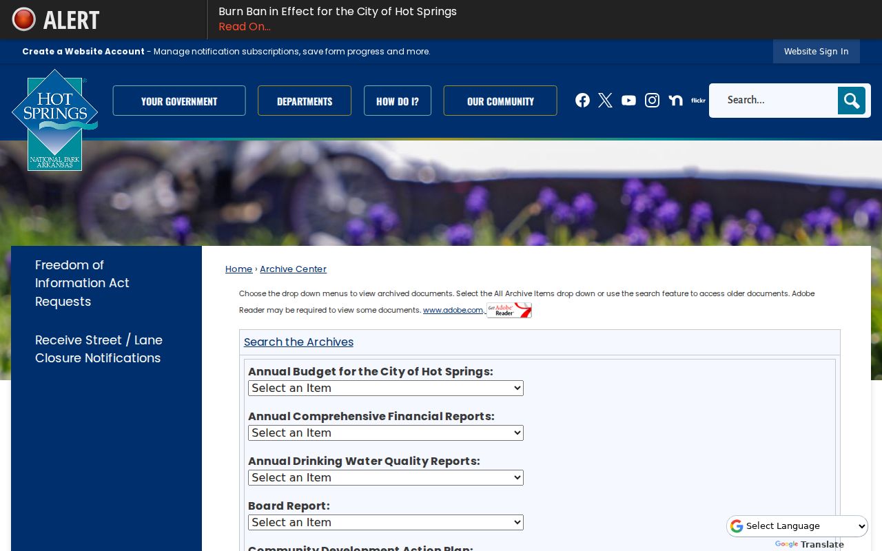
The archive view can place a block within city decisions or reports, while parcel and directory sources remain the stronger evidence for named owners and historical occupants.
Official Hot Springs Neighbor Sources
Official records and commercial neighbor tools answer different questions. County and city sources identify the custodian, date, and record role. Commercial tools may merge old addresses, relatives, and reused phone data without showing the underlying record. They should not replace the parcel map, assessment card, voter rules, or archive citation.
| Source Type | Strength | Limit |
|---|---|---|
| Official parcel and city records | Named custodian, defined fields, dated public record | Owner or contact may not be an occupant |
| Voluntary community sources | Current public contacts and local context | No right to a private member roster |
| Commercial matching tools | May surface leads for later verification | Stale, merged, or unexplained data |
If a block search reveals a suspicious solicitation, fake record claim, or identity-theft attempt, report it through an official channel. The Federal Trade Commission fraud reporting portal accepts consumer reports.

The federal form is a reporting route, not a directory. Keep screenshots, dates, messages, and the official record used to verify the claim.
Privacy Around Hot Springs Neighbors
Public parcel geometry supports lawful block research, but it does not justify publishing a named roster of private people. Suppress protected addresses, minors, full birth dates, signatures, account numbers, and identifiers. Utility customer and DMV address data are restricted. Sealed court records, juvenile matters, and eligible Address Confidentiality Program addresses also stay outside a neighbor lookup.
Neighborhood Services files may document the condition and chronology of a property case. They can also contain exempt details or information about a complainant. Request the address-based official file and accept lawful redactions. Do not turn a caller, applicant, contractor, registered agent, or tax-mail recipient into a resident without separate evidence.
Lawful use. Hot Springs neighbors may be researched for civic curiosity, reconnection, and safety awareness. Never use records to watch, threaten, harass, or expose a protected person.
Internet-enabled threats or fraud can be reported through the FBI Internet Crime Complaint Center.
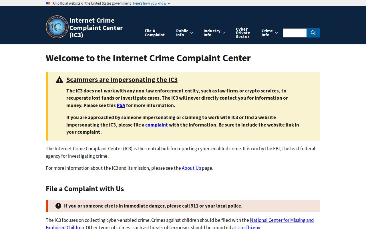
That reporting channel is appropriate when a digital scheme or threat emerges from misuse of address data. Immediate danger should go to 911.